How Professional Drone Services are Transforming Data Collection in Atlantic Canada
- Jan 23, 2023
- 2 min read
Updated: Nov 6, 2025
In recent years, the use of drones has skyrocketed across a wide variety of industries. Unmanned aerial vehicles (UAVs) have become essential tools for collecting data in ways that traditional methods simply cannot match. From infrared camera inspections to 3D mapping and stockpile measurements, drone services are providing more accurate data than ever before—and the possibilities are growing each day. Let’s take a closer look at how drones are revolutionizing the way we collect and analyze data.

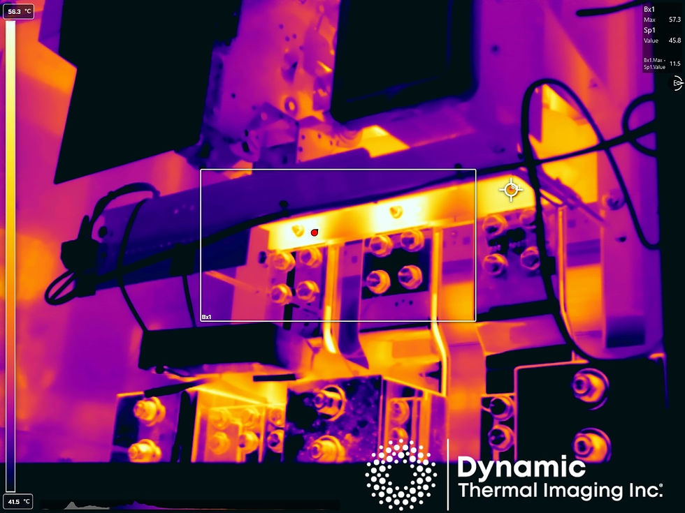
Drone Inspections with Infrared Cameras

When it comes to inspecting solar arrays, thermography is the gold standard for accuracy and reliability. With an infrared camera mounted on a drone, operators can identify faulty solar strings and cells in a fraction of the time it would take to inspect from the ground. The combination of high-definition image capture and thermal imaging allows technicians to pinpoint issues faster than ever before—saving time, money, and resources in the process.
3D Mapping and Photogrammetry

Photogrammetry is another powerful tool in the UAV arsenal that enables users to conduct highly precise 3D mapping quickly and accurately. This technology uses an algorithm to compare overlapping images taken by a drone’s onboard camera, allowing operators to create detailed maps and models that provide actionable insights into land topography or development projects. Photogrammetry also allows users to measure distances between two points with just one click—eliminating much of the guesswork associated with traditional surveying methods.
Powerline Inspection & Digital As-Builts

In addition to its agricultural applications, drones have become invaluable tools for powerline inspection services as well. Whether you’re looking for a powerline inspection or creating a digital as-built map of your assets, drones equipped with advanced sensors can deliver high-quality images in no time at all—providing you with an up-to-date snapshot of your assets’ condition so you can plan your next steps accordingly. And when it comes to stockpile measurement for mining ad quarrys operations, drones offer unprecedented accuracy thanks to their sophisticated imaging capabilities paired with specialized software solutions designed specifically for mining operations analysis.
Agriculture Applications for Drones

The agriculture industry is leveraging drones in increasingly innovative ways as well—from using them to view crop health from above to understanding topography of land for irrigation purposes or fertilizer application. By taking advantage of sensors such as multispectral cameras paired with analytics software, farmers can make better decisions about their crops without having to leave their office or farmhouse doorsteps.
Professional drone services offer unprecedented accuracy when it comes collecting data—from solar array inspections and 3D mapping down to stockpile measurements and powerline inspections. For companies across industries including agriculture, utilities, municipalities, telecoms, and more these services are providing new opportunities for greater efficiency while saving both time and money in the process. If you haven’t explored how professional drone services could benefit your business yet — now is definitely the time!


Comments